Two Medicine - Red Eagle Lake Trail
Multi-Day Hike
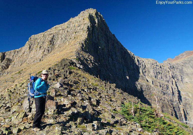
Triple Divide Pass, Glacier National Park.
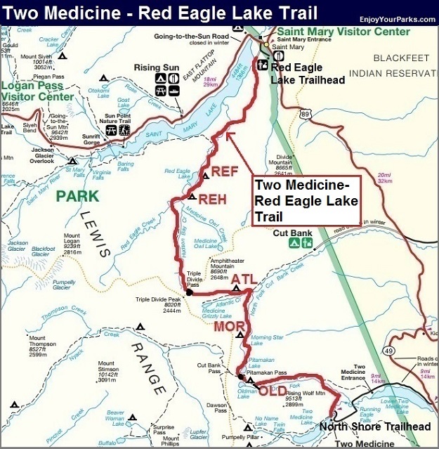
Two Medicine - Red Eagle Lake Trail
Multi-Day Hike - Detailed Description
(From Two Medicine Campground to Red Eagle Lake Trailhead via Pitamakan Pass and Triple Divide Pass)
Trailhead: Two Medicine North Shore Trail at Two Medicine Campground
Distance: 33.4 miles
Elevation Gain: 4,181 vertical feet
Elevation Loss: 4,861 vertical feet
Maximum Elevation: 7,548 vertical feet (Pitamakan Pass)
Mountain Passes: Pitamakan Pass (7,548 feet)
Mountain Passes: Triple Divide Pass (7,397 feet)
Backcountry Campgrounds:
Old Man Lake (OLD), Morning Star Lake (MOR), Atlantic Creek (ATL), Red Eagle Lake Head (REH), Red Eagle Lake Foot (REF)
Overview
The hike from the North Shore Trailhead at Two Medicine Campground to Red Eagle Lake Trailhead is a popular 33.4 mile hike over two passes (Pitamakan Pass and Triple Divide Pass), with fantastic scenery the entire hike. Three different areas are involved, which include the Two Medicine Area, Cutbank Area and St. Mary Lake Area. Total vertical gain and loss is over 9,000 feet, so you will definitely want to be in good shape for this one.
The first night is spent at Old Man Lake before climbing up and over Pitamakan Pass and then dropping down to Morning Star Lake in the Cutbank Area where there rests another backcountry campground. Just three miles further awaits the Atlantic Creek Campground. Between the Cutbank Area’s Atlantic Creek Campground and Red Eagle Lake Head Campground in the St. Mary Lake Area is the famous Triple Divide Pass. Beyond Red Eagle Lake Foot Campground is a gradual descending hike through a burnt forest (Red Eagle Fire 2006) where the trail eventually ends at the Red Eagle Lake Trailhead one half mile from the East Entrance (St. Mary) to Glacier Park.
TWO MEDICINE – RED EAGLE LAKE TRAIL DESCRIPTION
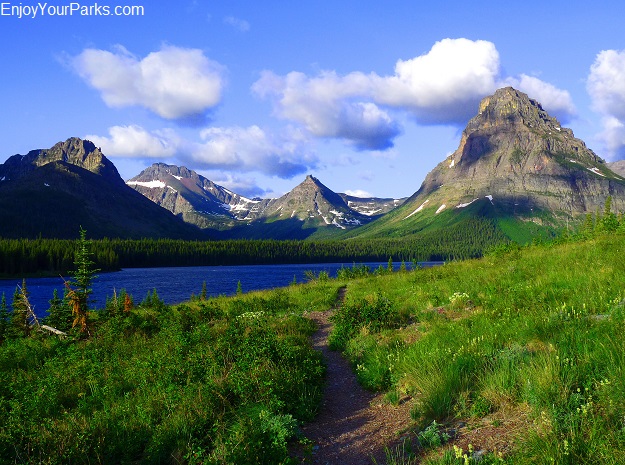
Two Medicine Area North Shore Trail
Two Medicine North Shore Trailhead (mile 0.0)
Your hike will begin at the Two Medicine Campground, where you’ll find the North Shore Trailhead at the other side of a large footbridge that crosses Pray Lake. At the trailhead sign, instead of taking a left onto the North Shore Trail, take a right towards Old Man Lake and Pitamakan Pass.
Old Man Lake Campground (OLD), mile 7.9
The trail works it’s way up Dry Fork Creek, with the iconic Rising Wolf Mountain towering over you to the south (left). In a few miles you will begin to see a prominent horn to the west, directly in front of you, which is Flinsch Peak. Old Man Lake rests in a cirque below this famous mountain. The ascent is gradual as you will climb over 1,900 vertical feet in this 7.9 mile stretch. Old Man Lake Campground is where you will spend your first night. The view of the lake with Flinsch Peak rising directly over it to the west is fantastic.
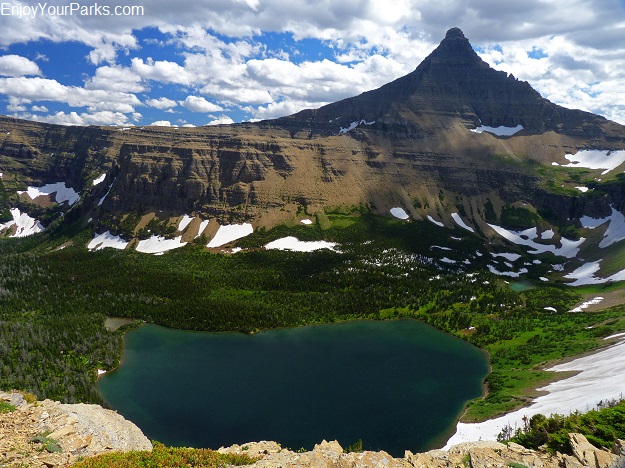
Old Man Lake and Flinsch Peak from Pitamakan Pass.
Pitamakan Pass and Cutbank Creek Trail Junction (mile 8.9)
Pitamakan Pass is located to the north of Old Man Lake, about 500 vertical feet above the campground. This one mile section of trail takes you up a slope just north of the lake, and each step provides an even more dramatic view of Flinsch Peak and Rising Wolf Mountain. Once you reach Pitamakan Pass, you’ll really enjoy the view to the south of these great mountains (Flinsch and Rising Wolf) as well as Old Man Lake, and to the north you’ll be able to look into the Cutbank Creek Area. Pitamakan Lake is directly below you to the north, and high above you to the northwest is Cutbank Pass, which takes hikers into and out of the Nyack Area. This area is a remarkable high alpine open slope, covered in tundra and void of trees.
Near Pitamakan Pass is the Cutbank Creek Trail Junction that takes you down into the Cutbank Area to the north. The trail to the left continues up to Cutbank Pass, which you can clearly see from this vantage point as it is all open alpine tundra. Take a left to drop into the Cutbank Creek Drainage. Pitamakan Lake is directly below you as the trail descends along the south west slope above the lake.
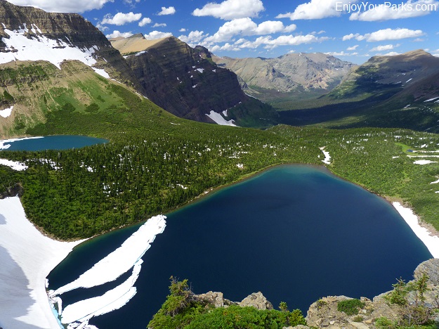
Pitamakan Lake from Pitamakan Pass.
Pitamakan Lake (mile 10.1)
The trail continues through the open tundra just west of Pitamakan Lake, and eventually skirts along the north shore of the lake where you’ll cross the North Fork Cutbank Creek near the outlet. The trail continues to descend as it follows the Cutbank Creek Drainage toward Morning Star Lake, where you’re next campground is located.
Morning Star Lake Campground (MOR), mile 11.1
About a mile beyond Pitamakan Lake lies the scenic Morning Star Lake. Nestled under the south buttress cliffs of Medicine Grizzly Peak, the setting for Morning Star Lake is breathtaking, and will be one of the highlights of your hike. You may want to camp here for the night and enjoy the lake, or keep moving onward to Atlantic Creek Campground.
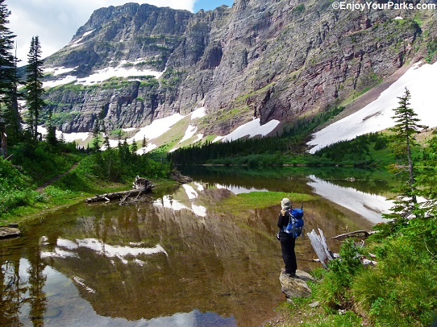
Morning Star Lake
Triple Divide Pass Trail Junction (mile 13.8)
When the trail leaves Morning Star Lake, it will take you through the incredibly gorgeous open green valley of the North Fork Cutbank Creek, which Medicine Grizzly Peak to your left (west) and Red Mountain and Eagle Plume Mountain to your right (east). This is a remarkable section of trail as you head toward the Triple Divide Pass Trail Junction that you will reach at mile 13.8. Take a left to enter onto the Triple Divide Pass Trail.
Atlantic Creek Campground (ATL), mile 14.2
Mile 14.2 is where the Atlantic Creek Campground (ATL) awaits you. This campground is heavily wooded with no remarkable vistas to speak of.
Medicine Grizzly Trail Junction (mile 14.5)
At mile 14.5 you will encounter the Medicine Grizzly Lake Trail Junction at the foot of the Atlantic Creek Valley. Stay right to keep heading toward Triple Divide Pass.
Triple Divide Pass (mile 17.1)
Just beyond the Medicine Grizzly Trail Junction at mile 14.5, the trail begins to abruptly steepen, climbing 2,000 vertical feet in just over 2.5 miles to Triple Divide Pass. The scenery along this section of the trail is amazing, with Razoredge Mountain in front of you to the west, and Medicine Grizzly Lake far below at the base of this prominent mountain. You will soon begin to see the massive Atlantic Creek Headwall, with Triple Divide Peak looming at it’s north end and Razoredge Mountain rising from the south end of the headwall. The higher you get, the better the views become. Once you reach Triple Divide Pass (7,397 feet), Triple Divide Peak is directly above you to the west, and Mount James to the east. To the north you can look down the Hudson Bay Creek Valley where Red Eagle Lake is located.
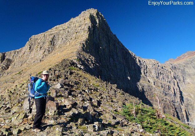
Triple Divide Pass with Triple Divide Peak.
About Triple Divide Peak
Triple Divide Peak is one of the most unique peaks on earth, as its summit marks the exact spot where two Continental Divides meet. So if you pour a glass of water onto the summit, a third of the water will end up in the Pacific Ocean via the Columbia River, a third will end up in the Atlantic Ocean via the Missouri River, Mississippi River and the Gulf of Mexico, and a third will end up in the Arctic Ocean via the St. Mary River and Hudson Bay.
Red Eagle Lake Head Campground (REH), mile 24.9
From Triple Divide Pass, the trail descends fairly steeply down the other side into the Hudson Bay Creek Valley, with several switchbacks making it a little easier for you. You are heading north at this point. As you continue to drop in elevation, near Red Eagle Lake you will cross Red Eagle Creek and begin heading northeast onto more level ground until you reach the Red Eagle Lake Head Campground (REH) at mile 24.9. The north view is dominated by the massive Red Eagle Mountain that towers above the lake, which you will see the entire way down from Triple Divide Pass. The campground rests at the head of Red Eagle Lake, providing excellent views of the lake and surrounding area.
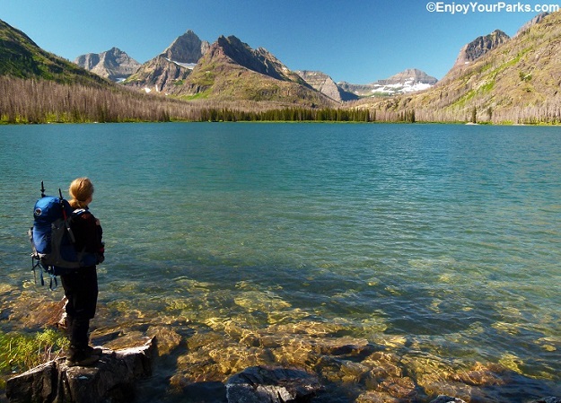
Red Eagle Lake
Red Eagle Lake Foot Campground (REF), mile 25.8
Red Eagle Lake Foot Campground is located one mile from the head campground, as the trail follows the south shore of Red Eagle Lake. You can’t help but notice the aftermath of the Red Eagle Fire of 2006 as you get closer to the foot campground, however the area is still quite scenic.
St. Mary Lake Trail Junction (mile 28.2)
From the Red Eagle Lake Foot Campground, the trail continues downhill through the remnants of the Red Eagle Fire of 2006, with a surprising amount of dead trees still standing. In 2.4 miles you will reach the St. Mary Lake Trail Junction, where you will stay right to continue on the Red Eagle Lake Trail. You will encounter some creek crossings via very well built foot bridges.
The Red Eagle Fire (2006) aftermath is quite dramatic during this section of the hike, where an ancient fir forest completely burned. Younger trees are beginning to dominate the landscape, however the white dead fir trees are everywhere, reminding you of a forest that once was.
The wildflowers are quite remarkable at times throughout this section of the hike, which are very enjoyable to hike through. There are some vast green meadows that at times are filled with wildflowers and fantastic views of the surrounding mountains.
1913 Ranger Station Trail Junction (mile 32.2)
The Red Eagle Trail connects to an old road, and continues toward the trailhead on this road. At mile 32.2 you will encounter the 1913 Ranger Station Trail Junction. Stay left to stay on the Red Eagle Lake Trail.
Red Eagle Lake Trailhead (mile 33.4)
At mile 23.5 your hike ends at the Red Eagle Lake Trailhead. This trailhead is located about a half mile from St. Mary and the East Entrance.


