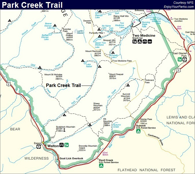
Park Creek Trail
Includes Lake Isabel
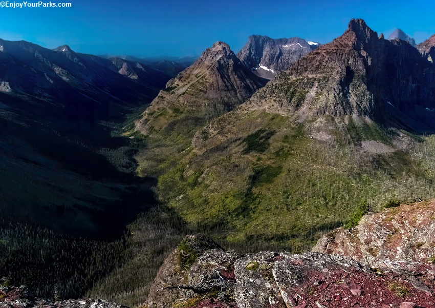
Park Creek Valley, Glacier National Park
Park Creek Trail
Trailhead: Two Medicine Lake Parking Lot, South Shore Lake Trailhead
Distance: 26.3 miles (one way)
Elevation Gain: 1,456 vertical feet
Elevation Loss: 2,900 vertical feet
The Park Creek Trail hike in Glacier National Park begins at the Two Medicine Lake parking lot, and from there you will hiker over the top of Two Medicine Pass and drop into the abyss of the Park Creek Valley. You will hike the entire length of this long, remote valley and end up at the Walton Ranger Station, which is 26.3 miles from where you started. The Park Creek Trail is of course is mainly intended for a multi-day backpacking experience. Is this not one of our "Favorite Multi-Day Hikes in Glacier Park," but for those of you who like to explore seldom visited areas, this might be a hike to consider.
Finding The Trailhead
The Park Creek Trail hike in Glacier National Park begins at the Two Medicine Lake parking lot in the Two Medicine Area. The actual trailhead where your hike begins is located right next to the boat dock, which is the South Shore Trail trailhead. You will see a sign right next to the boat dock. For more information on the Two Medicine Area, click here.
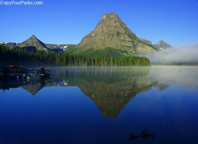
Two Medicine Lake, Glacier National Park.
South Shore Trailhead (mile 0.0)
Your Park Creek Trail hiking adventure in Glacier National Park begins at the South Shore Trail trailhead. This trail parallels the south shore of Two Medicine Lake as it works it's way to the west. You will get a great view of Sinopah Mountain along this pleasant section of your hike.
North Shore Connecting Trail Junction (mile 2.3)
Just under Sinopah Mountain, 2.3 miles from where you started, you will encounter the North Shore Connecting Trail junction. Stay left and continue onward along the south side of Sinopah Mountain.
Rockwell Falls (mile 3.4)
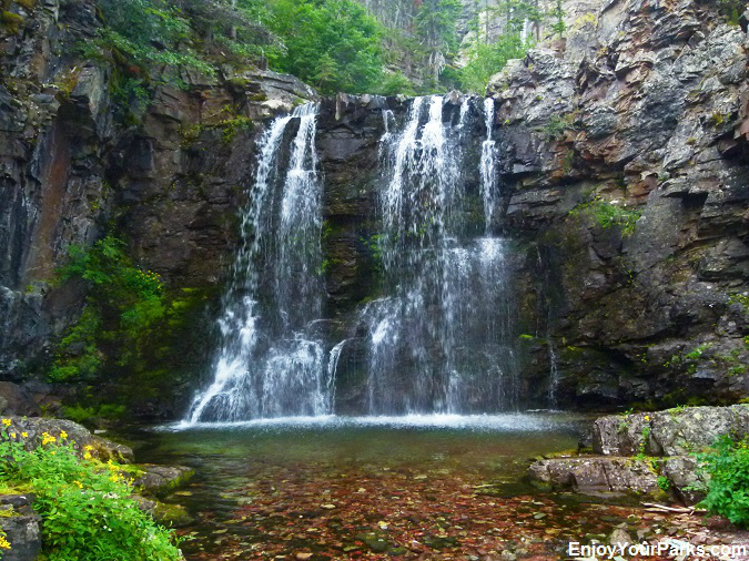
Rockwell Falls, Glacier National Park.
At mile 3.4, you will encounter the ever-popular Rockwell Falls. This is a good place to take a quick break and enjoy these scenic falls. The trail then begins to gradually climb between the mountains of Painted Tepee Peak to the south (left) and Sinopah Mountain to the north (right). You will follow a very nice mountain stream that runs out of Cobalt Lake that is very pleasing to the eye.
Cobalt Lake and Cobalt Lake Campground (mile 5.7)
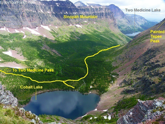
Cobalt Lake as viewed from Two Medicine Pass, Glacier National Park.
Cobalt Lake is where you will spend your first night on your Park Creek Trail hiking adventure in Glacier National Park. This is a very scenic area, and the lake is a very, very dark blue due to it's depth... thus the name "Cobalt". There are two campsites at this designated back country campground, and you will need reservations from the NPS in advance. Cobalt Lake is nestled directly below Two Medicine Pass to the west, and the west ridge of Painted Tepee Peak to the south. There is usually snow on the far end of the lake well into August.
Two Medicine Pass (mile 7.7)
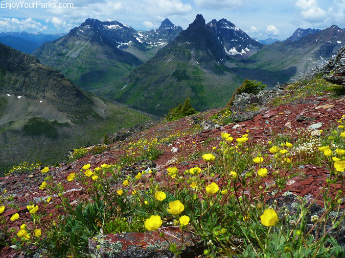
Two Medicine Pass, Glacier National Park.
From Cobalt Lake in Glacier National Park, you will begin to steeply climb up to the ridge of Two Medicine Pass. The actual pass is at the far south end of this long, high ridge, whereas you will enter this ridge to the north, just below Mount Rockwell. The views all along this ridge are spectacular, and you will get a great view of a portion of the Park Creek Valley, as well as Lake Isabel, Vigil Peak, Mount Saint Nicholas, Battlement Mountain, Grizzly Mountain and much more. And guess what? You will actually summit Chief Lodgepole Peak as the trail takes you along the Two Medicine Pass ridge!
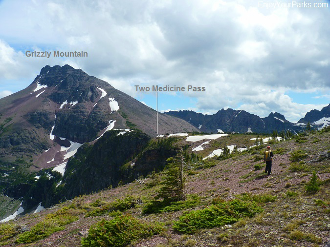
Two Medicine Pass with Grizzly Mountain, Glacier National Park.
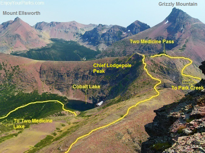
Two Medicine Pass as viewed from Mount Rockwell in Glacier National Park.
For more details on Two Medicine Pass, Visit Our Two Medicine Pass Page.
Once you've hiked the long Two Medicine Pass ridge southward, you will eventually reach the actual Two Medicine Pass on the south end of the ridge, just below Grizzly Mountain. From here, the trail drops very abruptly into the abyss of the Park Creek Valley. This is the steepest section of the Park Creek Trail, and you'll be thankful you're going DOWN instead of UP!.
Upper Park Creek Campground (mile 11.7)
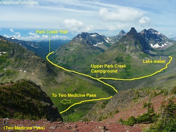
A view of the Park Creek Valley from Two Medicine Pass in Glacier National Park.
Once you've reach the valley floor, you will then spend the night at the Upper Park Creek Campground, which is about 6 miles from Cobalt Lake (if you choose not to go further to Lake Isabel). There is also a patrol cabin near this campground, which is used by the Glacier Park trail crew periodically throughout the summer. You will also notice that a forest fire came through this entire area several years ago, changing the scenery dramatically. You will also cross Park Creek near the Upper Park Creek Campground.
Lake Isabel Trail Junction (mile 11.7)
Near the Upper Park Creek Campground there is the Lake Isabel Trail that takes you to Lake Isabel. The distance from this junction is 2.3 miles one way, and there is a backcountry campground at this gorgeous lake called the Lake Isabel Campground. This is a popular place for hikers to stay the night while on their Park Creek Trail hiking adventure in Glacier National Park. Lake Isabel is surrounded by towering giants such as Vigil Peak and Battlement Mountain, creating an incredibly scenic landscape. Again, keep in mind that there was a forest fire that dramatically affected this area several years ago.
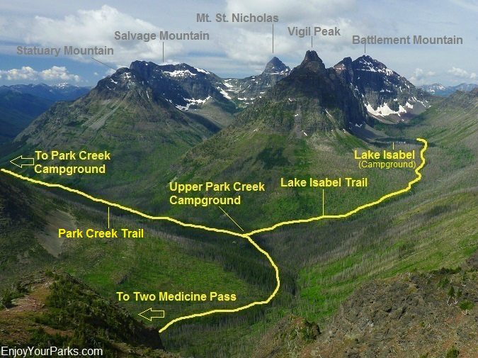
Lake Isabel Trail as viewed from Two Medicine Pass in Glacier National Park.
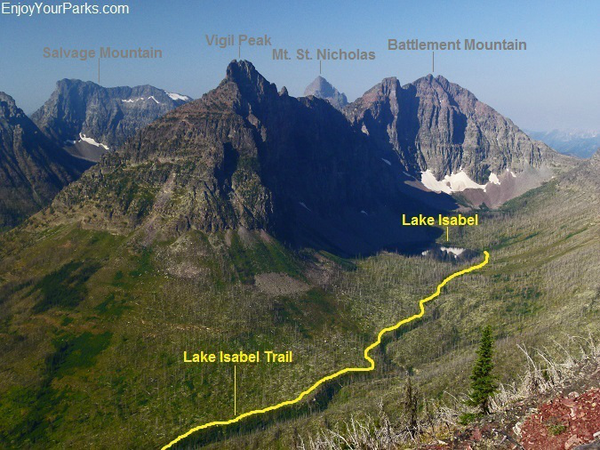
Lake Isabel Trail in Glacier National Park. Vigil Peak and Battlement Mountain towers over Lake Isabel.
Park Creek Campground (mile 19.1)
From the Upper Park Creek Campground, the Park Creek Trail in Glacier National Park gradually works its way southward down the Park Creek Valley, with Park Creek paralleling the trail to your right. In about 7.4 miles from Upper Park Creek Campground, you will reach the Park Creek Campground at mile 19.1.
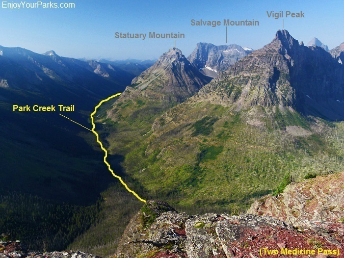
Park Creek Trail as viewed from Mount Rockwell in Glacier National Park.
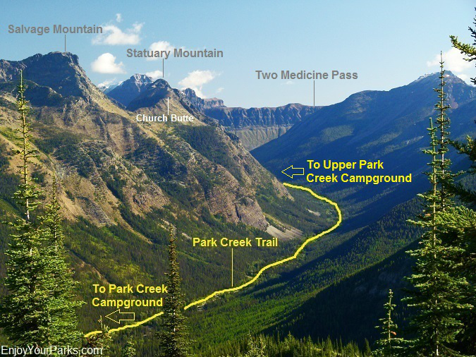
This is a view of the Park Creek Valley from the Scalplock Lookout in Glacier National Park. You can actually see Two Medicine Pass from this vantage point.
Fielding Coal Creek Trail Junction (mile 19.1)
Next to the Park Creek Campground in Glacier National Park, you will see the Fielding Coal Creek Trail junction. This trail runs perpendicular to Park Creek, as well as Ole Creek to the southeast and Coal Creekto the northwest. The Fielding Coal Creek Trail essentially connects all three of these valleys. Of course ignore this trail junction and continue onward along the Park Creek Trail.
Boundary Trail / Ole Creek Trail Junction (mile 25.2)
As you continue down the Park Creek Valley along the Park Creek Trail in Glacier National Park, in 6.1 miles you will encounter the Boundary Trail / Ole Creek Trail Junction. Take a right onto the Boundary Creek Trail, which will lead you to the Walton Ranger Station in 1.1 miles, after crossing Ole Creek on a well built suspension bridge.
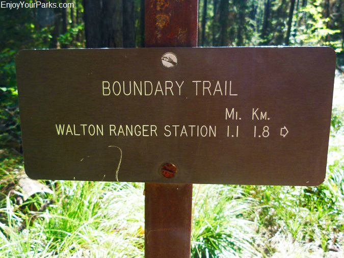
From this sign, you are only 1.1 miles from Walton Ranger Station, which marks the end of your Glacier Park hiking adventure along the Park Creek Trail.
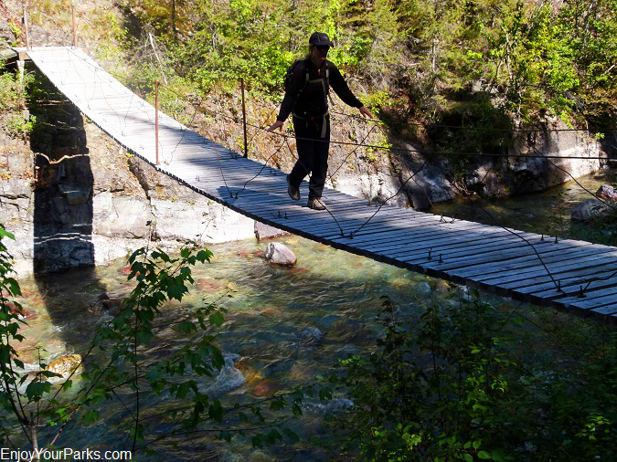
Suspension bridge over Ole Creek on the Boundary Trail in Glacier National Park.
Walton Creek Ranger Station (mile 26.3)
This concludes your Glacier National Park hiking adventure along the Park Creek Trail. Obviously it's best to have a car waiting for you at the Walton Ranger Station, so you can drive back and pick up your other vehicle that's parked at the Two Medicine Lake parking lot.
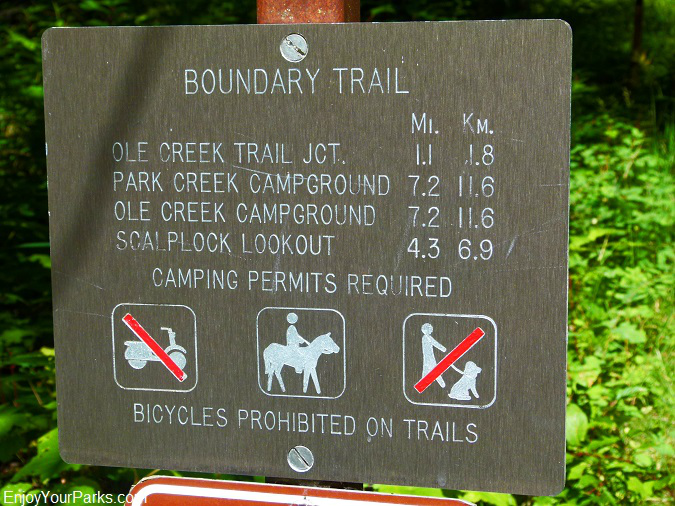
This is the trailhead sign for those Park Creek hikers starting at Walton Ranger Station in Glacier National Park.
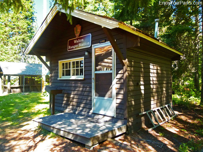
The Walton Ranger Station in Glacier National Park... marking the end (or beginning) of your Glacier Park hiking adventure along the Park Creek Trail.


