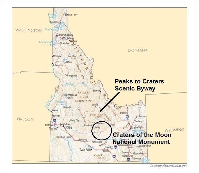
Craters of the Moon National Monument
Includes Peaks To Craters Scenic Byway
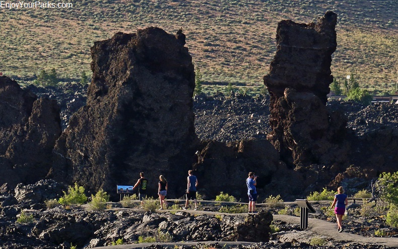
Craters of the Moon National Monument, Idaho
 Craters of the Moon National Monument and Preserve is located in south central Idaho along the Peaks To Craters Scenic Byway, and is one of the top geological attractions in the country. This fascinating 750,000 acre national monument and preserve is home to over 53,500 acres of incredible volcanic formations and lava flows.
The Craters of the Moon National Monument is a place that seems not of this world. One word to describe this unusual terrain that we use often is “strange”.
Within this gigantic monument and preserve rests over 53,500 acres of volcanic formations and lava flows that seem to have been formed yesterday. And when referring to geological time, it was practically yesterday!
The name “Craters of the Moon” came from it’s original founders in the early 1900s who envisioned the surface of the moon to look just like this strange and fascinating place.
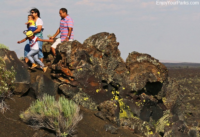
Craters of the Moon National Monument and Preserve in Idaho.
 Established on May 2, 1924 by a proclamation from President Calvin Coolidge, the Craters of the Moon National Monument is found in what is known as the Snake River Plain of central Idaho and is along U.S. Highway 20 between the towns of Carey and Arco.
This remarkable national monument features some of the best-preserved flood basalt (lava) areas in the lower 48 states.
In November of the year 2000 and again in 2002, by presidential proclamations from President Bill Clinton, the Craters of the Moon Monument Area was greatly expanded, reaching over 750,000 acres. This expanded area is known as the Craters of the Moon National Preserve, and is managed by the National Park Service and Bureau of Land Management.
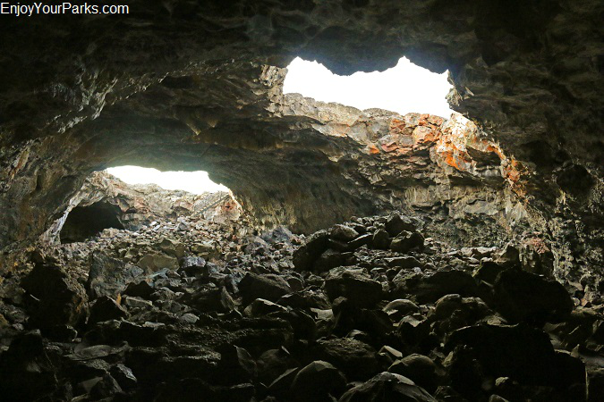
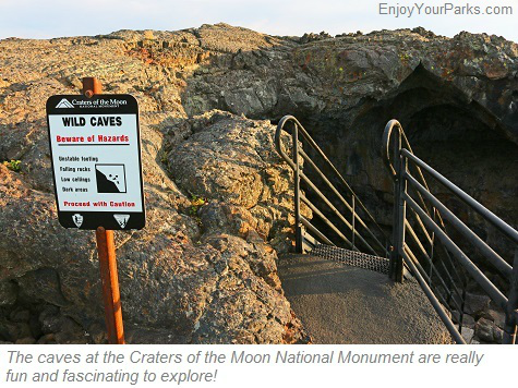
The caves at Craters of the Moon National Monument are fascinating to explore!
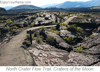
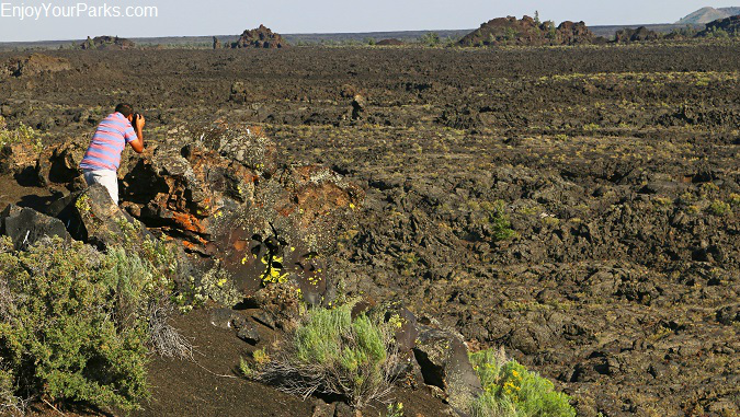
Craters of the Moon National Monument and Preserve in Idaho.
Rare and Fascinating Geology
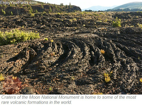 The Craters of the Moon National Monument and Preserve includes three huge lava fields and hundreds of square miles of sagebrush grasslands… with the total area being over 1,117 square miles.
These three giant lava fields rest along what’s known as the Great Rift of Idaho, which is some the absolute best examples of “open rift cracks” in the world. These rift cracks include the deepest open rift crack on earth, being over 800 feet deep!
There are also outstanding examples of nearly every variety of basaltic lava known to man, and also lava tube caves, tree molds and a large variety of many other interesting volcanic features.
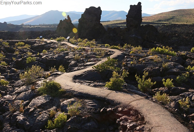
Craters of the Moon National Monument and Preserve, Idaho
Geological History
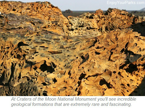 The Craters of the Moon National Monument and Preserve was created between 15,000 and 2,000 years ago during eight major eruptive periods. The most recent eruptions around 2,000 years ago created the Wapi Lava Field and Kings Bowl Lava Field. Geologically speaking, 2,000 years ago, and even 15,000 years ago for that matter, is extremely recent when you think about the earth being a whopping 4.5 billion years old.
Basalt lava erupted from what is known as “The Great Rift”, which is a series of very deep cracks in the earth. These cracks begin near the Craters of the Moon Visitor Center, and actually reach over 53 miles to the southeast. While these lava flows were occurring, the lava fields eventually covered well over 618 square miles.
This entire region has experienced "stretching" over the course of 30 million years. This stretching commonly creates not only earthquakes but also lava flows. In 1983, the Mount Borah earthquake caused the tallest peak in Idaho to grow 12 inches, and the Lost River Valley to drop eight feet. But these forces that typically build mountains, on the Eastern Snake River Plan these forces trigger volcanic activity such as lava flows and eruptions. These eruptions and flows occur approximately every 2,000 years, which is how long it's been since the last eruption.
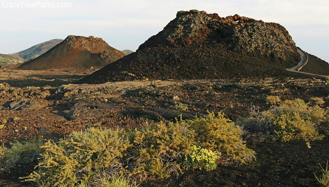
Spatter Cones, Craters of the Moon National Monument and Preserve in Idaho.
The Loop Road
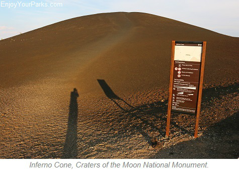 At the Craters of the Moon Visitor Center, there is a wonderful paved roadway known as "The Loop Road" which takes visitors to many of the main attractions of Craters of the Moon National Monument.
The Loop Road is also is where some outstanding trailheads are located to take hikers along short yet extremely fascinating hikes, as well as hikes into more remote areas of the Craters of the Moon Preserve.
Please see the map below to get an idea of all the incredible attractions the Crater of the Moon National Monument has to offer. Keep in mind that Craters of the Moon National Monument is open every day of the year, however the loop road and several of the park facilities are closed during the winter. See map below....
Popular Points of Interest
North Crater Flow Trail
Devils Orchard Nature Trail
Inferno Cone Trail
Snow Cone / Spatter Cones Trail
Dewdrop Cave
Beauty Cave
Boy Scout Cave
Indian Tunnel
North Crater Trail
Broken Top Loop Trail
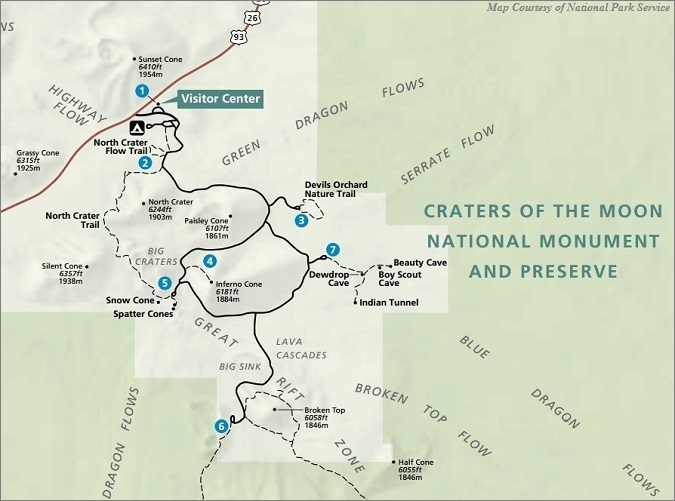
The Loop Road in Craters of the Moon National Monument.
Lava Flow Campground
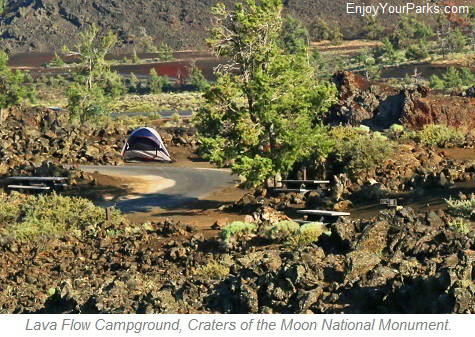 The Lava Flow Campground is located along the Loop Road close to the Craters of the Moon National Monument Visitor Center. There are 51 sites available, and are on a first come first serve basis as no reservations are accepted. The Lava Flow Campground has drinking water, restrooms, charcoal grills and picnic tables.
There are no hookups, showers or waste water dumping stations. No wood fires are allowed. There are only a few sites that can accommodated large RVs and trailers, so please keep this in mind while planning your trip to Craters of the Moon National Monument.
Group Camp
Group Camp is located about a mile up a gravel road on the northern side of U.S. Highway 20/93/26, and are by reservation only and available from April through September. This camping area is designed for larger groups of a maximum of 30 people. Group Camp has picnic tables, drinking water, a vault restroom and campfire grate. Campfires are only permitted within the campfire grate and the gathering of wood is not permitted.
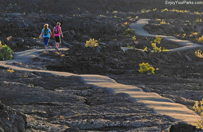
Craters of the Moon National Monument is a fascinating place to explore and enjoy!
Peaks To Craters Scenic Byway
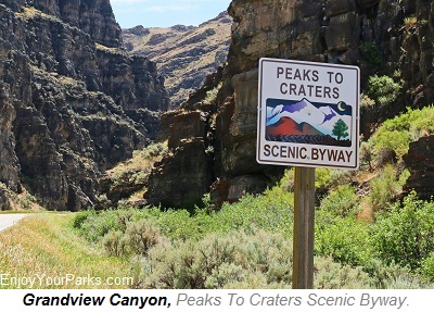 The Peaks To Craters Scenic Byway runs between Challis Idaho and Shoshone Idaho, and the Craters of the Moon National Monument is one of the highlights of this scenic roadway. One of the most diverse scenic byway in the great state of Idaho, the Peaks to Craters Scenic Byway takes its travelers through amazing wetlands, high deserts, massive lava flows.
The Peaks To Craters Scenic Byway also is located next to the tallest peaks in Idaho, which are found in the legendary Lost River Mountain Range.
The Peaks To Craters Scenic Byway begins at the intersection of U.S. Highway 93 and State Highway 75 just south of Challis Idaho. As the roadway heads southward, you will soon enter the spectacular Grandview Canyon with its towering walls on each side of the highway.
The road then begins to climb as it works its way to Willow Creek Summit, which has an elevation of 7,161 feet above sea level. At this scenic summit, to the south you will cast your eyes onto the incredible central peaks of the Lost River Mountain Range, which is home to Idaho's tallest peaks, including Idaho's tallest mountain Mount Borah at 12,662 feet.
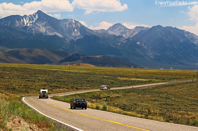
The Lost River Range towers to the east of the Peaks To Craters Scenic Byway for 75 miles.
Lost River Range
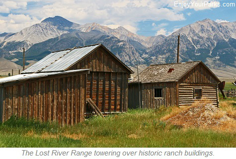 The Lost River Range runs for 75 miles along the east side of the Peaks To Craters Scenic Byway of Idaho, beginning near the Salmon River near Challis.
The Lost River Range starts quite unsuspectingly at only 5,000 feet near the Salmon River, however the Lost River Range quickly climbs in elevation to Grouse Creek Mountain (11,085 feet) and Dickey Peak (11,141 feet).
When the Peaks To Craters Scenic Byway reaches Willow Creek Summit (7,161 feet), travelers will then get an incredible view of the great central peaks of the Lost River Range, which are the tallest mountains in Idaho. Mount Idaho (12,065 feet), Mount Breitenbach (12,140 feet), Mount Church (12,200 feet), Leatherman Peak (12,228 feet) and Lost River Mountain (12,078 feet) are among these towering giants of the Central Lost River Range. However the giant of them all is Mount Borah, the tallest peak in Idaho at 12,662 feet above sea level.
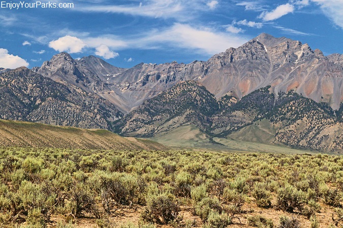
Lost River Range along the Peaks To Craters Scenic Byway in Idaho.
Mount Borah
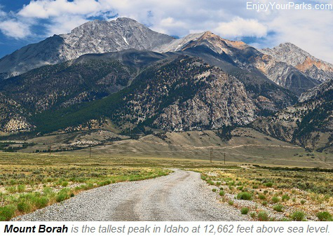 The Peaks To Craters Scenic Byway takes you right along side Mount Borah, where there are several hiking trails that take experienced hikers to Mount Borah.
Near Mount Borah, along the byway is the Mount Borah Earthquake Interpretive Site which highlights the 1983 earthquake where Mount Borah actually grew by 12 inches, and the valley floor sank up to nine feet!!!
This major earthquake was measured to be 7.3 on the Richter scale, and the interpretive site does a great job explaining this fascinating geological event that changed the landscape forever.
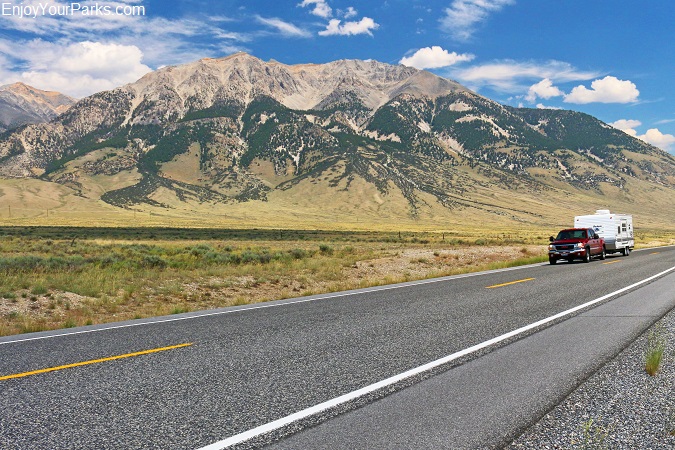
The Lost Range towering over the Peaks To Craters Scenic Byway in Idaho
Craters of the Moon National Monument
Carey Lake Wildlife Management Area, Silver Creek
Beyond Mount Borah, the Lost River Range will continue to be a breathtaking sight all the way to the town of Arco, which is America's first nuclear powered city. The Lost River Range then quickly descends into the Snake River Valley at an elevation of 5,300 feet. The Peaks To Craters Scenic Byway then continues to Craters of the Moon National Monument and Preserve, and ends near the junction of State Highway 75 and U.S. Highway 20. Just prior to this incredible scenic byway, you will pass by the Carey Lake Wildlife Management Area, which is home to many bird species and waterfowl, as well as the crystal clear waters of Silver Creek. This huge spring-fed creek is among one of the top fishing destinations in the world for anglers looking for really big rainbow and brown trout.


